Clarity

Real-time city emergency
management software

During times of crisis, Clarity shows disaster management groups where, how and why people are moving. It provides clear insights into where best to allocate critical resources during an emergency.

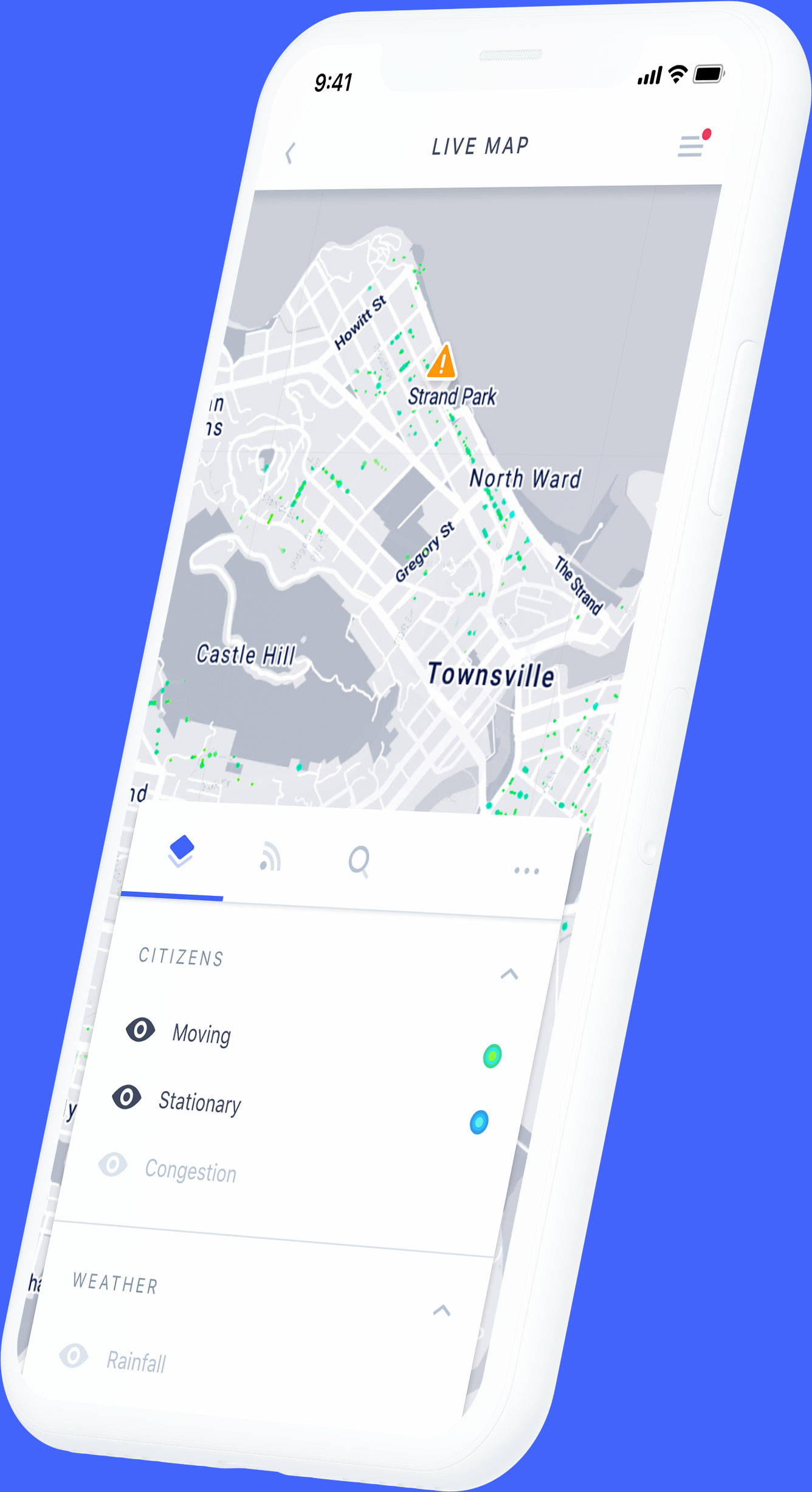
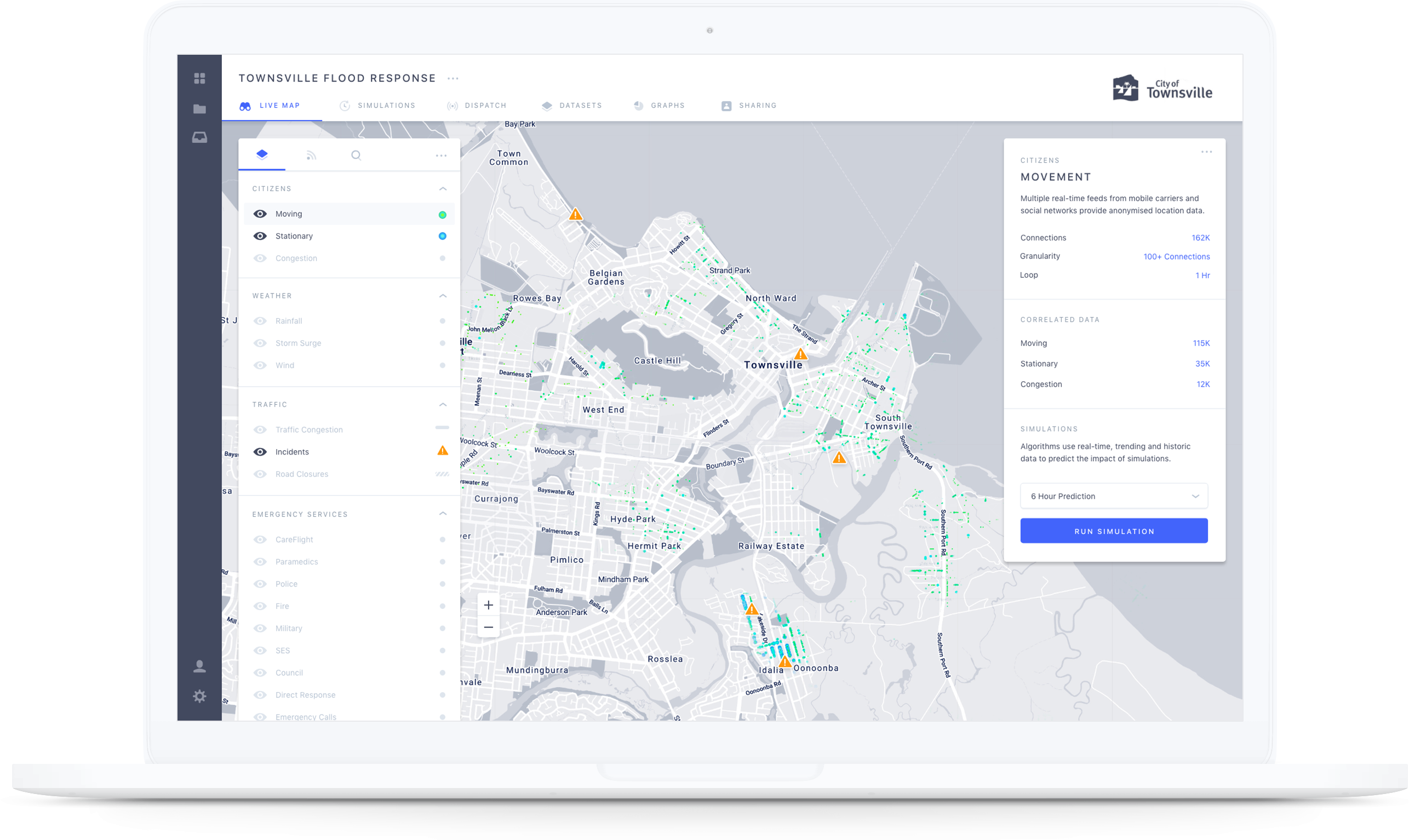
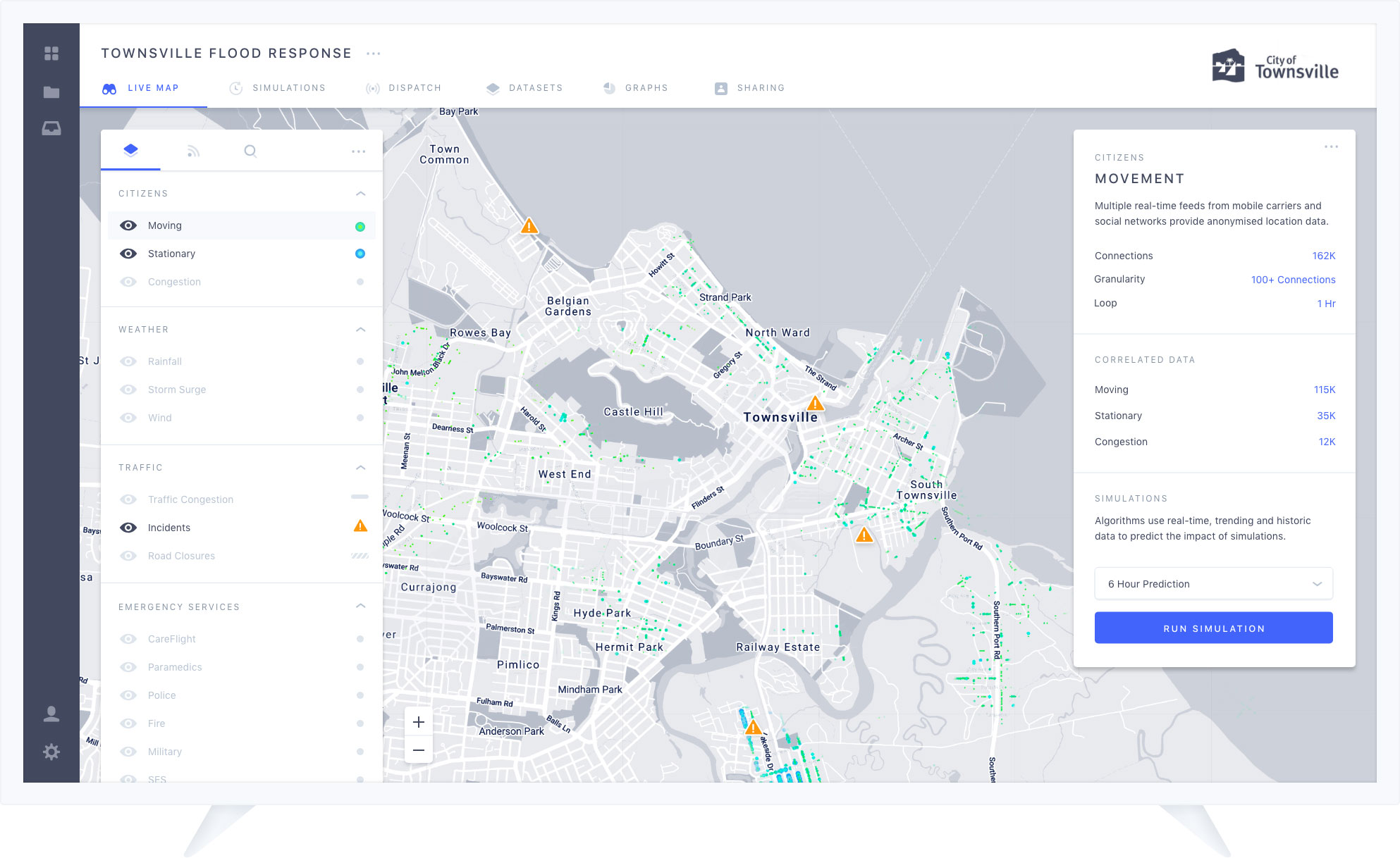
Monitor your city in real-time, simulate outcomes
and allocate resources with confidence

Clarity wishes to engage with local government and disaster management organisations to ensure the best
possible outcome during critical events. We welcome conversations with all stakeholders.

Contact Us

Be prepared to protect your city

Clarity makes sense of data using powerful technology

Mobile Carrier Location Data Social Network Location Data IOT Sensors Real-time Dashboards Web, Tablet, Mobile, Television Informed Decision Making Precise Resource Allocation Contextualise and enrich your data with other valuable data sources Create predictive models to inform critical decisions Weather forecasts Contextualised real-time location data Flood models Machine learning Predictive algorithms Traffic conditions and road closures Council data sources Geo-spatial information Other data sources Fire, Police, EMS, ABS etc. Aggregate and consolidate the real-time location, movement and demographic data of the people in your area